

PanoDrone Aerial Photography Services – What do I receive as an end product?
How the panoramic view is established
Each aerial panorama we provide is custom edited from several normal camera images and then custom stitched together into a single 360 degree image. After that process is complete after approximately 14 days, give or take, after the shoot we then send out proofs to our client as a reduced resolution edited panorama for each elevation. If NYC based the turn around time may be faster.
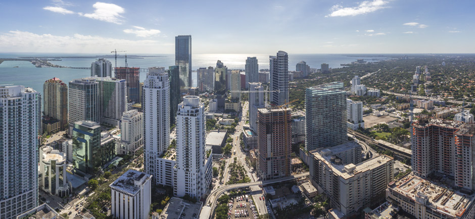
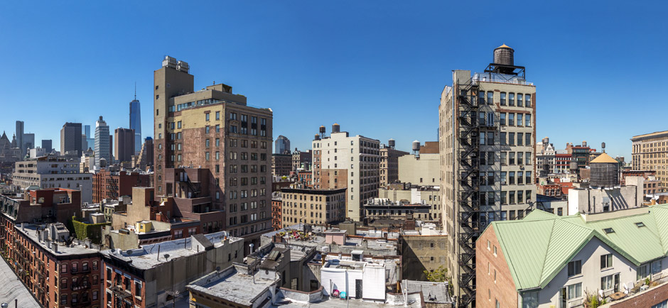
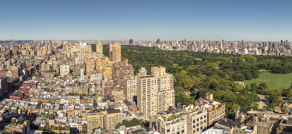
Aerial Panorama NYC
Panoramic viewer download
When the time comes to download the final high resolution aerial photography we send links to download zip files that contain all the files needed to run the same pano-viewer on your computer or website as well as all of your final edited images.
Zipped files to download
The download file size can be large so you will need a high speed internet connection. The files are all contained inside a “zipped” folder that must be “unzipped” after download. On a PC right clicking on the folder after download will usually give you options for unzipping the files. If not, you may need to download a free application called “Winzip” you can visit there website here.
What’s inside the zip folders & what to look for
Inside the zip folders you will find many files related to the interactive Panorama and may seen like gibberish at first but don’t move them around. Look for an .html file or web page document, open that up for each elevation and there you have your pano-viewer ready to be enjoyed and put online by your web person. If you look around you will also see a folder named “Flattend Panos” or similar, thats where you have a stand alone flat .jpg and/or .tiff image of each panorama at several different qualities.
Quality of the files
The highest quality flat image typically comes in at about 200-300 megabytes at a resolution of about 25,000 x 3200 +/- a few pixels. Thats large enough to make a spectacular print if you wanted to. Imagine future view aerial photography with more resolution than HD!
Optional aerial 360 or panoramic services
- Each panoramic 360 future view notes the elevation in meters (default)
- Compile each elevation panorama into its own interactive viewer for individual linking from your website. (default)
- Optional – have us place a small google map of the location on a panorama. (default is no map)
- Optional – compile all elevations panoramas into a single web viewer with thumbnails for viewers to see all elevations.
Aerial Panorama 360 Views
This is a sample download from an actual client. It represents the same default future view photography format that we use for all our clients. It contains several different panoramic altitudes within the single folder. Each folder also contains the various sized flat images.
Download Deliverable Samples 1Gb